|
Getting your Trinity Audio player ready...
|
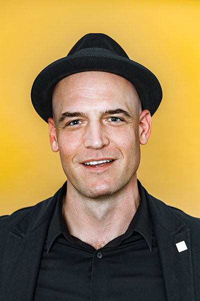
Patrick Wallis, the facilities and workplaces practice lead at Esri, knows how to make a space flow. But rather than looking inside to adjust furniture or lighting fixtures, he starts from an unlikely place: above.

Esri is a company focused on geographic software and technology, and Wallis is charged with leading the professional services practice implementing Esri technologies that enhance work environments. His team uses location technology to streamline workflows for space management, facilities management, and other workplace responsibilities like workplace experience. And by using mapping technology like artificial intelligence, Wallis and his team enable their customers to build and operate workspaces more innovatively.
To create workplace maps, Wallis uses products like ArcGIS Indoors to consolidate multiple building information models and computer-aided design into a single floor-aware map. To stitch these interior views into a seamless tapestry with the rest of the world, Esri also uses products like “ArcGIS Drone2Map,” where Wallis and his team work with partners that send drones to collect hundreds of images from above that are related to a real-world location. The tech then combines those images to create orthophotos, aerial photographs that have been flattened and corrected to allow viewers to measure ground distances.
Once the workplace maps and orthophotos are created, the team decides how best to map effective workflows for clients based on specific needs, space constraints, and the progress customers have already made in their project.

“In a sense, the world is our new map and we’re overlaying these digital layers on top to get work done faster and to improve our current experience,” says Wallis.
With the convergence of our digital and physical world using technologies like ArcGIS Indoors and Drone2Map, Wallis says he is focused on “working smarter, not harder.” And creating an experience seamlessly for clients is made possible by that convergence. Esri’s workplace mapping technology is done by taking raw data and filtering it through the hierarchy of the structure of the building, according to Wallis.
“In these cases, we’re just leveraging technology and doing it smartly. Buildings have an inherent hierarchy that we can leverage through this technology to provide intelligence,” he says. “That’s what’s driving me to take these technologies and wrap them around our customers.”
After working at Esri for ten years, Wallis says that the intersection of digital and reality is present now, whether we realize it or not.
“We’re dealing with technology a few years ahead of the game because we’re working with things that aren’t released,” he says. “We have to figure out what’s current for the customers. We’re trying to constantly gauge what year the customer is in versus where we are now.”
Using that new technology is one imperative part of creating smarter workspaces, but communication is key to making a project run smoothly. Communicating effectively is a skill Wallis picked up during his time spent in the Army. It was in his role as a platoon leader, as a new graduate from Tulane University, where he learned that recognizing the limits of your knowledge and having self-awareness is what enables you to bridge communication gaps.

Wallis believes a leader should be technically proficient but not an expert on everything. Instead, it’s imperative to gain and maintain trust through listening and meeting the customer’s needs. “It’s about listening to use cases, the real business drivers, and those different domains, and contemplating what we can do with our mapping technology to build solutions for them,” says Wallis.
Great developments like ArcGIS Indoors and drone mapping unfolding in the space is also something Wallis is familiar with, as he saw the digitalization of mapping during his military time occur right in front of him. When he first began in the Army, he recalls that the platoon would bring the equipment needed to do mapping into the field. “We even had a photolithography van where we stored all these chemicals. We were still using light tables,” he says.
However, with his formal education in architecture lining up during the conversion from analog to digital, he was able to tap into his skills and see movement. “Using some of the skills I learned in architecture school, on the digital side, we were able to do some test runs and some early digital photolithography techniques,” Wallis says.
Eventually, they implemented some of the first machines used in the digitalization process for mapmaking in the US Army. According to Wallis, these machines were added to the master inventory list for every Army topography unit at the time.
“That made me understand my little system and the whole system at large. I remember that staying with me—whatever organization you’re in, you need to look at large to see how the pieces fit together to make a real change,” says Wallis.
Wallis emphasizes that having a foot in both camps of technology and architecture is the only way to build smarter workplaces and facilities. “You need to have a technologist mindset,” he states. “If you’re in the buildings trade or architecture, these worlds are merging today; and if you’re not savvy on both sides, I don’t think you’re going to be good at either one.”
When it comes to creating an effective workflow for a client, Wallis also contends that understanding where the customer is coming from and what their needs are as a whole business are keys to building operative office environments.
“It’s about listening hard, being empathetic, and thinking comprehensively about a problem,” Wallis says. “It’s not about one domain of knowledge. For me, that really helps in the world of technology. I think we innovate more when we are able to overlap different worlds of experience. It’s not about how you experience a space—it’s about how they experience a space.”


